
Distances
How far Sappada really is
Sappada has no motorway and no railway. You reach it through two gateways, Friuli and Veneto, and from both there is more than an hour of mountain road left: about 75 min from the Carnia exit of the A23, about 80 min from the end of the A27. On this page you will find driving times measured city by city, the state of roads and passes with the day we read it, and what actually exists for those who do not drive.
Times measured on 6 October 2026 · roads re-read on 7 October 2026
Real footage · SappadaTriesteVillas, drone footage, spring 2026
- From Venice
- about2 h 30 min154 km
- From Munich
- about5 h 20 min308 km
- From Vienna
- about6 h 50 min465 km
- After the motorway
- about75 minfrom the Carnia exit, up Val Degano
01The map
Three gateways, and the last stretch is a mountain road
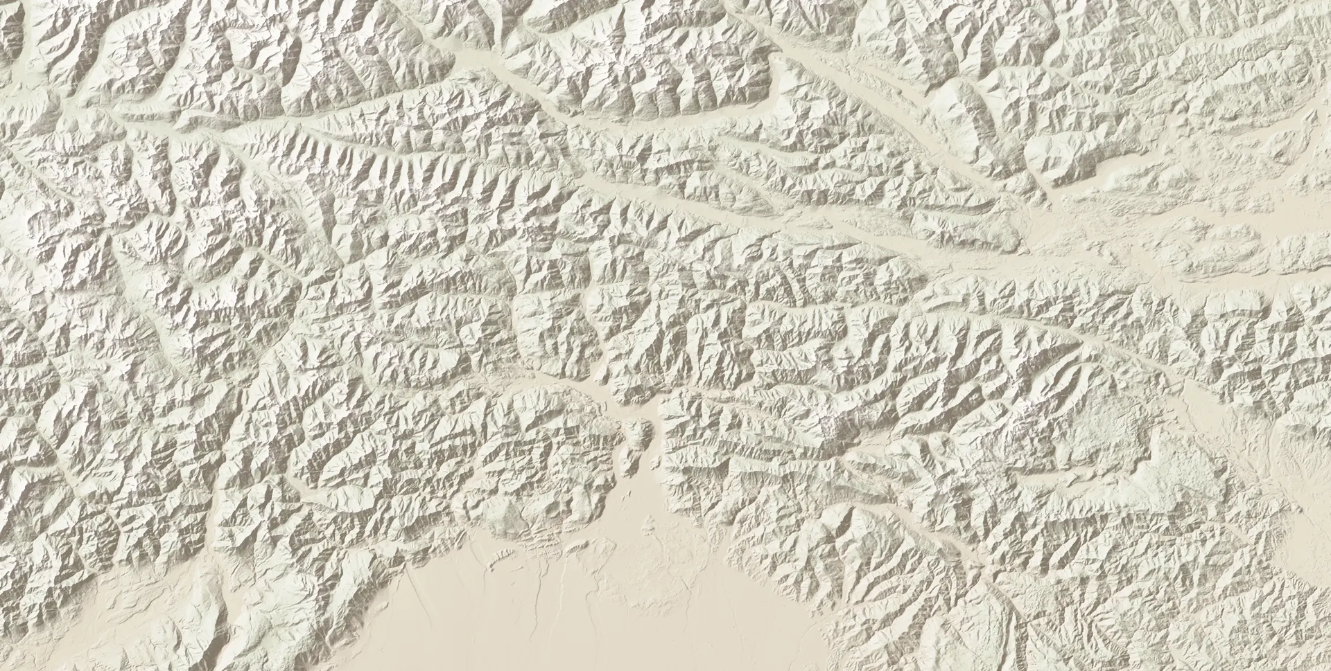
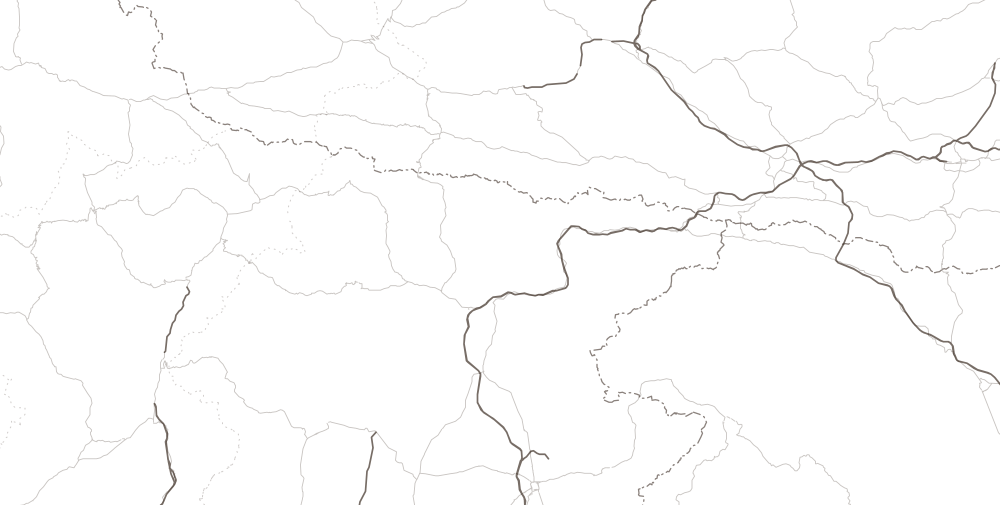
The valley has three ways in. From the east you climb Val Degano from the Carnia exit of the A23: this is the road for those leaving from Trieste, Udine, Carinthia, Vienna and Ljubljana. From the south-west you arrive through Cadore and Comelico, from the end of the A27: this is the road from Veneto and from Pordenone. From the north you come down from the Passo di Monte Croce di Comelico (Kreuzbergpass): this is the road from Munich, Tyrol and the Puster Valley. Choose your city: the road you would take lights up on the map.
- Udine1 h 50 min
- Villach2 h 20 min
- Tarvisio
- Zoncolan
- Forni di Sopra
- Piancavallo
- Cortina
- Tolmezzo
- Belluno
- Lienz
- San Candido (Innichen)
- Calalzo di Cadore
- Klagenfurt
- Carnia exit · A2375 min
- End of the A27 · Pian di Vedoia80 min
- 1
- 3
- 5
- 6
- Sappada
Relief calculated from Copernicus DEM GLO-30 elevations (© DLR and Airbus, provided by the European Union and ESA). Roads and borders © OpenStreetMap contributors, ODbL. The times beside the cities are the cautious estimate to Sappada.
From Venice to Sappada
about2 h 30 min
- By road
- 154 km
- On a clear road
- 2 h 06 min
- Among the six resorts
- fourth
You enter from Veneto: the A27 motorway to its end, at Pian di Vedoia, then Cadore, the Comelico tunnel and the last kilometres along the Piave.
From Venice: the road, stretch by stretch- Piancavallo: about 1 h 45 min by car, 100 km by road, 72 km as the crow flies
- Cortina d'Ampezzo: about 2 h 15 min by car, 147 km by road, 117 km as the crow flies
- Forni di Sopra: about 2 h 20 min by car, 151 km by road, 106 km as the crow flies
- Sappada: about 2 h 30 min by car, 154 km by road, 124 km as the crow flies
- Tarvisio: about 2 h 35 min by car, 210 km by road, 153 km as the crow flies
- Ravascletto · Zoncolan: about 2 h 40 min by car, 188 km by road, 126 km as the crow flies
From Venice, the same journey to the other resorts
| Resort | Cautious estimate | On a clear road | By road |
|---|---|---|---|
| Piancavallo | 1 h 45 min | 1 h 30 min | 100 km |
| Cortina d'Ampezzo | 2 h 15 min | 1 h 55 min | 147 km |
| Forni di Sopra | 2 h 20 min | 1 h 59 min | 151 km |
| Sappada | 2 h 30 min | 2 h 06 min | 154 km |
| Tarvisio | 2 h 35 min | 2 h 15 min | 210 km |
| Ravascletto · Zoncolan | 2 h 40 min | 2 h 16 min | 188 km |
02The ribbon of times
City by city, in order of time
The figure in evidence is our cautious estimate, the one we also write in sentences; beside it are the routing engine's time on a clear road and the kilometres by road. The colour tells you which gateway you enter by. From further away: from Milan it takes about 5 h 35 min, from Bologna about 4 h 15 min.
From Friuli Venezia Giulia and Veneto
| City of departure | Cautious estimate | On a clear road | By road | You enter by | |
|---|---|---|---|---|---|
| Belluno | 1 h 35 min | 82 min | 75 km | Cadore and Comelico | |
| Udine | 1 h 50 min | 1 h 35 min | 94 km | Val Degano | |
| Pordenone | 2 h 15 min | 1 h 56 min | 135 km | Cadore and Comelico | |
| Treviso | 2 h 20 min | 1 h 57 min | 133 km | Cadore and Comelico | |
| Monfalcone | 2 h 20 min | 1 h 58 min | 135 km | Val Degano | |
| Gorizia | 2 h 25 min | 2 h 02 min | 143 km | Val Degano | |
| Venice | 2 h 30 min | 2 h 06 min | 154 km | Cadore and Comelico | |
| Trieste | 2 h 45 min | 2 h 20 min | 164 km | Val Degano | |
| Padua | 2 h 55 min | 2 h 28 min | 188 km | Cadore and Comelico | |
| Vicenza | 3 h 15 min | 2 h 46 min | 219 km | Cadore and Comelico | |
| Verona | 3 h 45 min | 3 h 15 min | 269 km | Cadore and Comelico |
From Austria and Bavaria
| City of departure | Cautious estimate | On a clear road | By road | You enter by | |
|---|---|---|---|---|---|
| Lienz | 1 h 55 min | 1 h 36 min | 90 km | Monte Croce di Comelico | |
| Villach | 2 h 20 min | 1 h 59 min | 135 km | Val Degano | |
| Klagenfurt | 2 h 40 min | 2 h 19 min | 171 km | Val Degano | |
| Innsbruck | 3 h 20 min | 2 h 53 min | 182 km | Monte Croce di Comelico | |
| Salzburg | 4 h 30 min | 3 h 53 min | 271 km | Monte Croce Carnico | |
| Graz | 4 h 35 min | 3 h 56 min | 306 km | Val Degano | |
| Munich | 5 h 20 min | 4 h 37 min | 308 km | Monte Croce di Comelico | |
| Vienna | 6 h 50 min | 5 h 52 min | 465 km | Val Degano |
From Slovenia
| City of departure | Cautious estimate | On a clear road | By road | You enter by | |
|---|---|---|---|---|---|
| Kranjska Gora | 2 h 20 min | 1 h 58 min | 123 km | Val Degano | |
| Bled | 2 h 55 min | 2 h 31 min | 185 km | Val Degano | |
| Koper | 3 h 05 min | 2 h 37 min | 190 km | Val Degano | |
| Ljubljana | 3 h 30 min | 2 h 59 min | 230 km | Val Degano |
By car, without traffic: OSRM on OpenStreetMap data, measured on 6 October 2026. Each tick in the background is one hour. Venice is measured from Mestre. From Salzburg the calculated route crosses the Passo di Monte Croce Carnico (Plöckenpass): its state is further down.
03The same journey
The same journey to the other resorts
Same engine, same day, same rules: from each city we also measured Tarvisio, Zoncolan (from Ravascletto), Forni di Sopra, Piancavallo and Cortina d'Ampezzo. In each row the closest resort is marked. Sappada is not the closest from any of the ten cities: we say so first, because anyone choosing a home in the mountains does this sum anyway.
| From | Sappada | Tarvisio | Zoncolan | Forni di Sopra | Piancavallo | Cortina |
|---|---|---|---|---|---|---|
| Trieste | 2 h 45 min | 2 h 10 min (the closest) | 2 h 10 min | 2 h 30 min | 2 h 30 min | 3 h 25 min |
| Udine | 1 h 50 min | 80 min (the closest) | 80 min | 1 h 40 min | 1 h 55 min | 2 h 50 min |
| Pordenone | 2 h 15 min | 2 h 10 min | 2 h 10 min | 2 h 05 min | 60 min (the closest) | 2 h |
| Venice | 2 h 30 min | 2 h 35 min | 2 h 40 min | 2 h 20 min | 1 h 45 min (the closest) | 2 h 15 min |
| Treviso | 2 h 20 min | 2 h 40 min | 2 h 40 min | 2 h 10 min | 1 h 35 min (the closest) | 2 h 05 min |
| Padua | 2 h 55 min | 3 h | 3 h 05 min | 2 h 45 min | 2 h 10 min (the closest) | 2 h 40 min |
| Munich | 5 h 20 min | 4 h 25 min (the closest) | 5 h | 5 h 40 min | 6 h 50 min | 4 h 55 min |
| Vienna | 6 h 50 min | 5 h (the closest) | 6 h 15 min | 6 h 35 min | 7 h 30 min | 7 h 30 min |
| Villach | 2 h 20 min | 30 min (the closest) | 1 h 50 min | 2 h 05 min | 3 h | 3 h 20 min |
| Ljubljana | 3 h 30 min | 1 h 40 min (the closest) | 3 h | 3 h 15 min | 3 h 20 min | 4 h 20 min |
Cautious estimate by car, without traffic; OSRM measurements of 6 October 2026. Underlined, in each row, the closest resort.
The full comparison between the resorts: prices, pistes, altitude

04The state of the roads
Roads and passes, today
The state of a mountain road changes from week to week. For each entry we write what we read, where, and on which day. The numbers are those on the map above. Before you set off, check with the road operator.
Val Degano (SR355): the access from Carnia
OpenFrom the Carnia exit you follow the SS52 to Villa Santina and then the SR355, which climbs along the Degano river through Ovaro, Comeglians, Rigolato and Forni Avoltri. Between Comeglians and Cima Sappada it is one road only, with no parallel route: when it is interrupted, the detour runs through Forni di Sopra, the Passo della Mauria and Comelico.
This has happened twice because of landslips, on 24 November and 31 December 2022, and because of snow and avalanches in December 2020 and January 2021. The other closures we found were announced night-time works. In August 2026 the Region approved the designs for the whole stretch up to Cima Sappada, in two lots and three interventions: the funds allocated cover part of the cost estimated in 2024 for the whole stretch, and the timing of the works has not yet been published.
Read on 7 October 2026Source: FVG Strade, Infolavori · Friuli Oggi, 9 agosto 2026
Cima Sappada pass
OpenIt is the watershed between the Degano and the Piave and the highest point for those arriving from Friuli; the hamlet stands at 1,297 m. It has no scheduled winter closures, and the FVG Strade order treats it as an open road, with winter tyres or snow chains required. In heavy snow and avalanche danger, however, the stretch between Forni Avoltri and Cima Sappada has been closed: it happened in December 2020 and in January 2021.
The road in the municipality that closes every winter is another one: the Val Sesis road, which climbs from Cima Sappada towards the source of the Piave. In the 2025-26 season it stayed closed from 31 October to 15 May; the dates for the 2026-27 season have not yet been published.
Read on 7 October 2026Source: FVG Strade, ordinanza invernale · FVG Strade, strada della Val Sesis · Telefriuli, 2 gennaio 2021
Comelico tunnel (SS52): the access from Cadore
Closed at nightThis is the road for those arriving from Veneto. The tunnel has been under works since 2 September 2024 and, by order, from 23 March to 31 December 2026 it is closed to all vehicles every night, from 22:00 to 6:00, seven days a week. By day you pass on two narrow lanes, at reduced speed and with no overtaking. At night the detour runs over the Passo di Sant'Antonio, from Auronzo: it is longer and slower.
The night-time works are expected to last at least until 2028: the Government said so in its reply to the Chamber of Deputies on 10 December 2025. In peak periods, so far, the tunnel has stayed open at night too: at Easter and from 7 to 24 August 2026. It is not a written rule. The order expires at the end of the year and will have to be renewed: what will happen between Christmas and Epiphany has not yet been published.
Read on 7 October 2026Source: ANAS, lavori della galleria Comelico · Camera dei Deputati, atto 5-04781
Acquatona gorge (SR355): the last kilometres from the west
OpenPast the tunnel, from Santo Stefano di Cadore you climb along the Piave for about 20 min. It was here, just west of the village, that a landslide came down in the night between 6 and 7 August 2024: the road reopened with alternating one-way traffic on the morning of 8 August, and in both directions on 11 December 2024.
So the Veneto side has two delicate points in a row, the tunnel and the gorge. In those days in August the local press wrote of Sappada “cut off from Cadore”: it could still be reached from Friuli. Today the stretch is open.
Read on 7 October 2026Source: FVG Strade, 11 dicembre 2024 · Messaggero Veneto, 7 agosto 2024
Passo di Monte Croce di Comelico · Kreuzbergpass (SS52)
OpenThis is the way in from the north, between Sesto (Sexten) and Comelico: Munich, Innsbruck, Lienz and the Puster Valley come this way. Of the three ways into the valley it is the highest.
We found no scheduled winter closure, but the source is weak and official confirmation is missing: in heavy snowfall it may close for a few hours. In winter, winter tyres or snow chains are required along the whole stretch.
Read on 6 October 2026Source: ANAS, obblighi invernali in Veneto
Passo di Monte Croce Carnico · Plöckenpass (SS52 bis): towards Austria
Open with restrictionsIt links Paluzza with Kötschach-Mauthen, in the Gail Valley, at 1,360 m. A landslide closed it on 2 December 2023. It reopened on 22 May 2026 with traffic lights and weight limits, at night too from 25 June, and to heavy vehicles from 21 July; the height and length limits were already there before the landslide, and remain. After some night closures in July, the last one we found was the night between 31 August and 1 September 2026. Its state in real time cannot be checked from here: ANAS provides it.
For Sappada it matters little: from Carinthia and Vienna the A23 is quicker, from Munich and Tyrol the Passo di Monte Croce di Comelico is. It serves those coming from the Gail Valley and from Salzburg. For the permanent solution, an alternative route or a tunnel, there is neither funding nor a date.
Read on 7 October 2026Source: ANAS, 21 luglio 2026 · MeinBezirk Gailtal, 8 settembre 2026
Winter tyres and snow chains
In Italy winter tyres, or snow chains on board, are required from 15 November to 15 April on the A23 and A27 motorways and on all the access roads: SS51, SS51 bis, SS52, SS52 bis, SR355 and SR465. The orders are renewed every year: the ones we read are for the 2025-26 season, the new ones come out in November.
In Austria the requirement starts on 1 November and applies when the road is in winter conditions.
Read on 7 October 2026Source: FVG Strade, ordinanza invernale · ANAS, obblighi invernali in Friuli Venezia Giulia · oesterreich.gv.at, Winterreifenpflicht
If a road closes
Sappada has two independent accesses, on two sides of the mountains and with two different operators. From 2022 to today they have never failed together. It did happen twice, in severe weather: on 29 October 2018, with storm Vaia, and on 2 January 2021, because of snow and avalanche danger, the road was closed on both sides and the village was cut off; in December 2020 an avalanche cut it off from Friuli. How long those closures lasted we have not yet reconstructed. Anyone buying a home for the winter should know this beforehand.
In ordinary cases a closure costs a detour. If the lower part of Val Degano closes, the Sella Valcalda (958 m) is enough, via Paluzza and Ravascletto, and the time changes little. If the upper part closes, the detour runs through Forni di Sopra, the Mauria pass and Comelico. If the Cadore side closes, from Veneto you enter from Friuli, along the A4 and the A23: it is the longest detour. At night, with the Comelico tunnel closed, the two accesses become one and a half.
Read on 7 October 2026Source: Il Gazzettino, 29 ottobre 2018 · Telefriuli, 9 dicembre 2020 · Telefriuli, 2 gennaio 2021
05Airports, trains, buses
Without a car: what is really there
Neither trains nor flights reach Sappada: from the airport or the station you continue by car, or by bus where there is one. The times in the tables are by car, to the town hall.
Airports
| Airport | By car, about | By road |
|---|---|---|
| Trieste TRS | 2 h 15 min | 133 km |
| Venice Marco Polo VCE | 2 h 25 min | 154 km |
| Treviso TSF | 2 h 25 min | 145 km |
| Klagenfurt KLU | 2 h 50 min | 176 km |
| Ljubljana LJU | 3 h 15 min | 211 km |
| Innsbruck INN | 3 h 25 min | 185 km |
| Salzburg SZG | 4 h 25 min | 272 km |
Trieste is the closest airport in time and has a railway station inside the airport: on the weekday we counted, six direct trains run as far as Carnia without a change, all from early afternoon onwards. Klagenfurt is close but small. For those arriving from the rest of Italy or Europe the reference airports are Venice and Trieste, always with a hire car. Routes and seasons change: check them on the airports' websites.
Trains
| Station | By car, about | By road |
|---|---|---|
| Calalzo di Cadore end of the line from Ponte nelle Alpi | 45 min | 33 km |
| San Candido (Innichen) Puster Valley railway | 65 min | 48 km |
| Dobbiaco (Toblach) Puster Valley railway | 70 min | 53 km |
| Carnia Udine–Tarvisio line | 80 min | 57 km |
| Sillian Drava valley line (ÖBB) | 80 min | 60 km |
| Ponte nelle Alpi junction for Belluno, Calalzo and Conegliano | 85 min | 67 km |
| Gemona del Friuli Udine–Tarvisio line | 1 h 35 min | 72 km |
| Belluno direct trains from Venice and Padua | 1 h 35 min | 75 km |
| Lienz Drava valley line (ÖBB) | 1 h 55 min | 90 km |
| Udine Udine–Tarvisio line | 1 h 50 min | 95 km |
No train reaches Sappada. The nearest station is Calalzo, but it is on a line that has no trains for about half the year: in 2026 it is closed from 28 March to 7 June and from 13 September to 12 December, with replacement buses from Belluno. The 2027 calendar has not been published.
On the Friuli side the station is Carnia: on the weekday we counted (Wednesday 14 October 2026) twelve trains arrive there from Udine, but none between 7:44 and 13:13. The Mi.Co.Tra. train between Udine and Villach, two pairs a day, also stops at Carnia.
Buses
From Friuli. TPL FVG line 120 climbs from Tolmezzo to Sappada and also stops at Cima Sappada and in the hamlets along the road. In the timetable in force since 14 September 2026 there are seven runs on school weekdays, eight on other weekdays and two on public holidays; the last one leaves Tolmezzo at 19:15. From Udine there is no direct bus: you change at Tolmezzo, and the whole journey takes more than two hours. On Sundays there is only one connection, in the evening.
From Veneto. Dolomiti Bus line 33 links Calalzo station with Sappada in under an hour, with seven direct runs from Monday to Saturday on school days; the last one leaves Calalzo at 16:30. From Venice two pairs of coaches a day reach Calalzo: with the one leaving Piazzale Roma at 6:20 and line 33 you are in Sappada in a little over three hours, with a single change of a few minutes. For Sundays, public holidays and non-school days, the Christmas holidays included, there is no published timetable: ask Dolomiti Bus.
From the north. From San Candido (Innichen) a bus runs down to Santo Stefano di Cadore over the Passo di Monte Croce di Comelico; for Sappada you change there.
Sappada can be reached without a car. Spending a weekend there without one, arriving on Friday evening or leaving on Sunday, is difficult today: anyone buying to let needs to know this.
Timetables read on 7 October 2026Source: TPL FVG, orari extraurbani · Dolomiti Bus, linee extraurbane · Cortina Express, orario Venezia–Calalzo–Cortina · RFI, quadro orario di Calalzo · RFI, quadro orario di Carnia · Trieste Airport, voli diretti
06Vignettes and tolls
For those arriving from abroad
Austrian motorways and expressways require a vignette; from 2027 it will be digital only. Some tunnels and pass roads are charged separately, at each passage: among them the Felbertauernstraße, which is the way down from Munich via Kitzbühel and Lienz, and the Karawanks Tunnel between Slovenia and Carinthia.
In Slovenia the vignette is electronic: weekly, monthly or annual. There is no one-day vignette.
From Ljubljana and from Bled there is also a route without the tunnel, via Kranjska Gora, the Rateče border crossing and Tarvisio: you pay only the Slovenian vignette and the Italian motorway, and the time changes little.
We have not recorded the tolls on Italian motorways. Rates change every year: that is why we refer you to the operators instead of copying them.
- Austrian vignetteFor anyone using motorways and expressways in Austria: from Vienna, Graz, Klagenfurt and Villach on the A2, from Salzburg on the A10.
- FelbertauernstraßeAt each passage. It is the way from Munich via Kitzbühel, Mittersill and Lienz.
- Karawanks Tunnel (A11)At each passage, on top of the two vignettes. It is the quickest way from Ljubljana and from Bled.
- Slovenian vignette (e-vinjeta)Weekly, monthly or annual: there is no one-day vignette.
- Rates are with the operators (read on 7 October 2026):ASFINAG · Felbertauernstraße AG, tariffe · DARS, e-vinjeta
Cities of departure
From your home, stretch by stretch
- From Udine1 h 50 min94 km · Val Degano
- From Pordenone2 h 15 min135 km · Cadore and Comelico
- From Treviso2 h 20 min133 km · Cadore and Comelico
- From Venice2 h 30 min154 km · Cadore and Comelico
- From Trieste2 h 45 min164 km · Val Degano
- From Padua2 h 55 min188 km · Cadore and Comelico
- From Villach2 h 20 min135 km · Val Degano
- From Munich5 h 20 min308 km · Monte Croce di Comelico
- From Vienna6 h 50 min465 km · Val Degano
- From Ljubljana3 h 30 min230 km · Val Degano
07Method and limitations
How we measure
Times and kilometres are calculated with OSRM on the OpenStreetMap road network, one request for each pair of points. The start is a central square or street in each city; the arrival is Sappada's town hall, in Borgata Bach. It is a calculation on a clear road: no traffic, traffic lights, roadworks or snow. The engine does not know, for example, that the Comelico tunnel is closed at night.
This is why in sentences and charts we write a more cautious estimate: the engine's time increased by fifteen per cent and rounded up to the next five minutes. It is a declared rule, not a measurement taken on the road. A second routing engine, Valhalla, gives almost the same times on the Friuli side and longer ones on the Cadore and Puster Valley side: there our estimate may not be enough.
Venice is measured from Mestre, Piazza Ferretto. For Zoncolan the arrival point is the town hall of Ravascletto, just below the cable car. Times by public transport are timetable connections read from the operators' timetables, not guaranteed connections.
For sellers
Do you own a home in Sappada? Show it to us.
Gathering and vetting sellers; in open dialogue with developers
Would you like to be the first to hear when a home comes up in Sappada?